
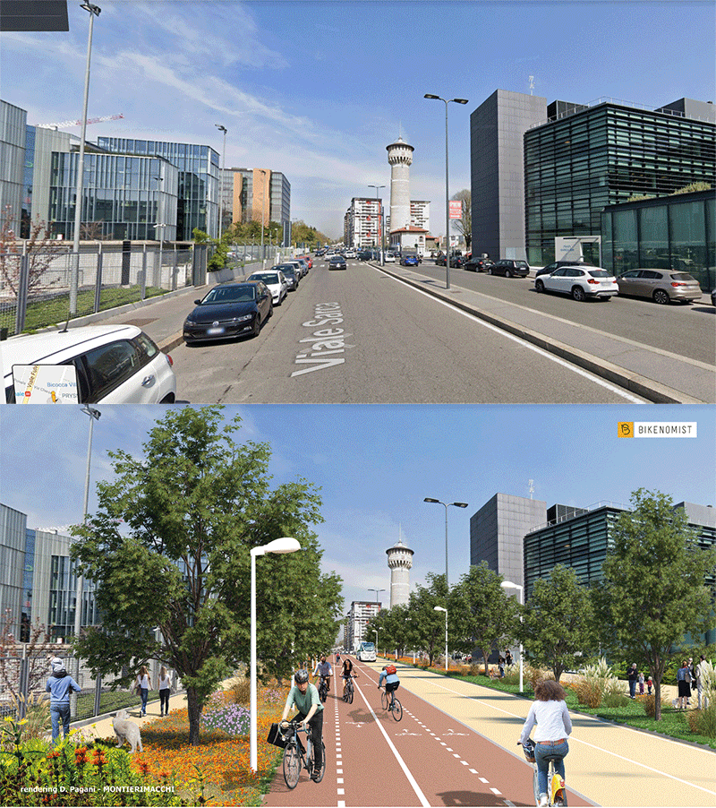
"You can't solve a problem by using the same tools that caused the problem," it is by following this mantra that we wanted to envision an infrastructure that could solve the problems of traffic, pollution, heat islands and the effects of climate change in one fell swoop. We started with the mobility pyramid, as it was conceived during the 1900s and how it should be structured in the new millennium to ensure accessibility, safety, and sociality for the greatest number of people: that is, giving top priority to those who move by foot, then to those who move by bicycle, to micromobility and cargo bikes, and then to public transportation and, finally, to cars, whether shared or private. Therefore, we decided to apply this logic to one of the most polluted and congested areas in Europe, the Milan-Sesto San Giovanni-Monza road axis, which has at least 30 thousand private motor vehicles traveling every day on a average of 8.6 km (round trip): a distance that, by bicycle, can be covered without impacting air quality in less than 30 minutes, which is less than the minimum daily physical activity recommended by the World Health Organization. After a careful study of all possible alternatives, we decided to go for the Viale Sarca axis, a secondary road that is oversized compared to real traffic and is very often used simply as a bypass to avoid the speed cameras and traffic lights of Viale Fulvio Testi. And here we asked ourselves: what would happen if we took 8 of the City of Milan's 1937 km of roads away from private, motorized traffic? After an evaluation of the various intersections and flows, we realized that there would be no major negative consequences and, indeed, the positive effects would far outweigh the negative effects. From here, we envisioned the street section: eliminating cars and parking lots to leave space solely for people, trees, flower meadows, bicycles and public transportation. And the result is what you see below, appropriately rendered by Montieri and Macchi Studio (whom we thank).
